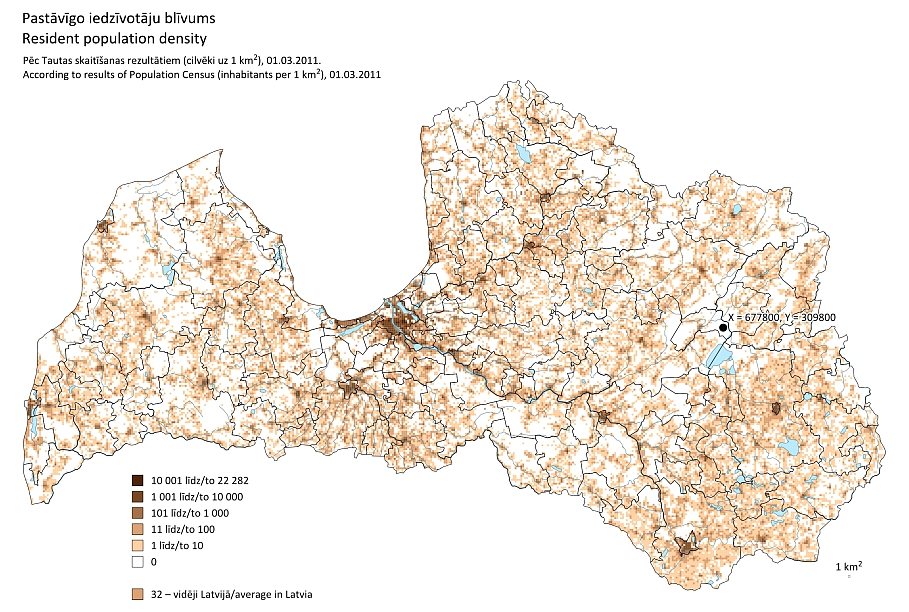
According to the CSB, arriving at the precise coordinates x=677800, y=309800 will land one seven kilometers away from the nearest human habitation, presumably a wood-side private homestead near the remote Klajotnis swamp (Klajotņa purvs). This 150-square meter uninhabited territory lies 170 kilometers east of Rīga.
The real news is that the CSB has finally completed its data-crunching work on the last official 2011 Population Census – including the siting of all homesteads onto precise geographical coordinates. As a result, spatial planning experts, researchers, students and other users of such data can now obtain up-to-date information on just about all residencies in the country.
The Census data have been rendered on a grid containing cells representing each square kilometer of the land. The national territory has been divided into altogether 65,600 such cells, of which 33,000 are inhabited according to the 2011 Census count.