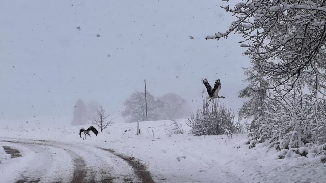
Webcams picked up flakes of the white stuff falling on the picturesque lake, with LSM weatherman Toms Bricis quickly reporting the incident to the wider world.
It is the fleeting shape of things to come, with a cold start to this week predicted, though snow that does fall will not last long as the end of the week is expected to be warmer.
Alūksnē snieg https://t.co/5CbPz5F6vf pic.twitter.com/Fvmc0FYmGO
— Toms Bricis (@boms_tricis) November 8, 2021
Snow will be seen Monday in many places in Vidzeme and Latgale regions. In the extreme east of Vidzeme and Latgale, a small layer of snow may even form on the ground. Roads will be icy in many places in all regions, so drivers are advised to proceed with caution.
Monday night will be the coldest this week, with temperatures dropping as low as - 7 Celsius in places and below freezing point more widely, with only coastal regions hovering around zero. Tuesday will be cold but also the brightest day of this week, with clear skies in the morning and cloud gathering in the afternoon. Temperatures will reach +1 to +6 Celsius.
On Tuesday night, a new precipitation zone will cross Latvia, which will bring rain in Kurzeme, but elsewhere it will come with snow and sleet which will turn into rain during the night. In many places in Vidzeme and Latgale, also in the east of Zemgale, a small layer of snow will form. But by morning the temperature will rise above zero throughout Latvia.
For the rest of the week the weather will get much warmer again, with temperatures in the afternoons in the range of +4 to +10 C. Rain and gusty winds will be widespread.