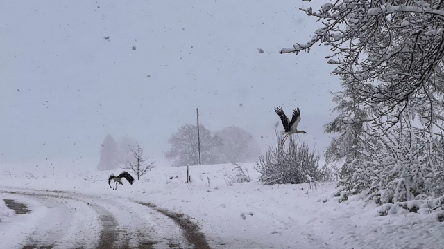
Western and central Vidzeme are hardest hit with strong winds roducing near-blizzard conditions with winds particularly strong along the coast at 20-22 meters per second.
In many places a layer of snow up to 6 centimeters thick will form and drivers are urged to take caution if they must use the roads.
Yet in other parts of the country clear, blue skies are the order of the day, as this tweet from the national weather forecasting service shows,
Šodien daudzviet Latvijā ir novērojama snigšana un vietām, galvenokārt Vidzemē, ir izveidojusies arī dažu centimetru bieza sniega sega - šobrīd Priekuļos tie ir 3 cm. Dažviet Latgalē nokrišņu zona nav vēl sasniegusi un spīd saule ?️☀️ pic.twitter.com/ZcCJIMOlnm
— Meteo.lv (@LVGMC_Meteo) April 14, 2020
Wintry conditions are expected to persist throughout much of the week. Night-time air temperatures will cool to + 2 to + 3 Celsius with rain, sleet and snow expected in many places in the first half of the week.
Gusty winds will continue until Thursday, when they will likely be at their strongest reaching 24 meters per second in eastern districts. The daytime air temperature will warm up to + 11 C with light rain is expected in many places, however, during the evening the clouds will dissipate and the sun will shine at last. The wind should gradually die down after that, though rain showers and gusts will continue until Sunday when more settled and pleasant conditions should arrive.