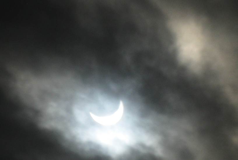
Forecasts allow for the possibility that some residents around Riga could witness the beginning of the eclipse at 10:56 up to its maximum phase at 12:05. However by the time the eclipse ends at 13:14, overcast skies should be over almost three-fourths of the land.
UPDATED with tweets, even from Ventspils, where the clouds shifted to allow the rare spectacle to be glimpsed:
Saules aptumsums bija vērojams arī @Ventspilslv :) Kādam vēl izdevās to iemūžināt fotogrāfijās? pic.twitter.com/2faDGYeb5n
— Ventspils.lv (@Ventspilslv) March 20, 2015
In the southwestern Rīga suburb of Ķekava.
Saules aptumsums Ķekavā pic.twitter.com/IIHhQKOZwb
— Ķekavas novads (@Kekavas_novads) March 20, 2015
And from right here at LSM headquarters on Rīga's Zaķusala:
Saules aptumsums, vērojot no @LatvijasTV Zaķusalā pic.twitter.com/nj03FLCtAR
— LTV Ziņu dienests (@ltvzinas) March 20, 2015
LSM's resident weatherman Toms Bricis shared a map that shows Latvia landing mostly under the swath of clouds over northern and western Europe while the solar eclipse tranpires.
Good weather to see the eclipse Friday early in central Europe, but poor in the north and west. #EUwx #eclipse2015 pic.twitter.com/pcx8aCSFzX
— Alan Reppert (@AReppert) March 19, 2015
In other weather news today, the cold front promises a brief return of winter this weekend, with sharply falling temperatures, overnight freezes, scattered rain and wet snow showers across the country after the clouds gather together by late Friday.
Winds will turn from the northeast and pick up in intensity overnight to Saturday, with the chance of occasional scattered precipitation, mostly light rain and wet snow. Low temperatures will be between zero and +4 degrees Celsius.
On Saturday night some locations may see light accumulations of snow, which will continue into Sunday only in the south of the country. Later the skies are expected to clear and a freeze will set in. Overnight to Sunday the lows will drop to between -2 and -7 degrees, during the day reaching highs of -1 to +4 degrees.
The following week will begin in the wake of the chill, but temperatures will begin to climb higher again to reach +2 to +8 degrees during the day, with overnight lows from -4 to +2 degrees before warmer weather is expected to return for next weekend.


